Track, Understand, and Combat Land Degradation in Iraq
Evidence, tools, and training to help Iraq achieve LDN (SDG 15.3).
Aligned with UNCCD good practice, Iraq LD Monitor tracks the three LDN indicators—Land Cover, Land Productivity, and Soil Organic Carbon—through regularly updated datasets and transparent methods. Interactive maps, time-series trends, and downloadable charts/statistics and maps support policy design that protects ecosystems while improving rural livelihoods.
By translating complex geospatial data into clear insights, Iraq LD Monitor strengthens national capacity to achieve LDN (SDG 15.3), respond to degradation hotspots, and measure progress against national strategies for sustainable land management.
Methodology
How do we monitor land degradation?
Land degradation refers to the gradual reduction or loss of land’s biological or economic productivity and complexity due to pressures such as land use and management practices. Under the framework of SDG 15.3 of the United Nations Convention to Combat Desertification, progress is measured using indicator 15.3.1, which calculates the proportion of degraded land over total land area. Because land degradation is multi-dimensional and cannot be captured by a single metric, the methodology relies on three complementary sub-indicators: land cover and land cover change, land productivity trends, and changes in carbon stocks, particularly soil organic carbon. These are combined using a precautionary “One-Out, All-Out” logic, whereby a land unit is classified as degraded if any one of the three indicators shows a negative trend. The approach enables consistent global monitoring and comparison over time, but it captures the presence rather than the severity of degradation and must be interpreted alongside national data, local context, and ground observations to effectively inform land restoration and sustainable land management policies.
Learn MoreDecision Support Tools
KPIs


Data & Products
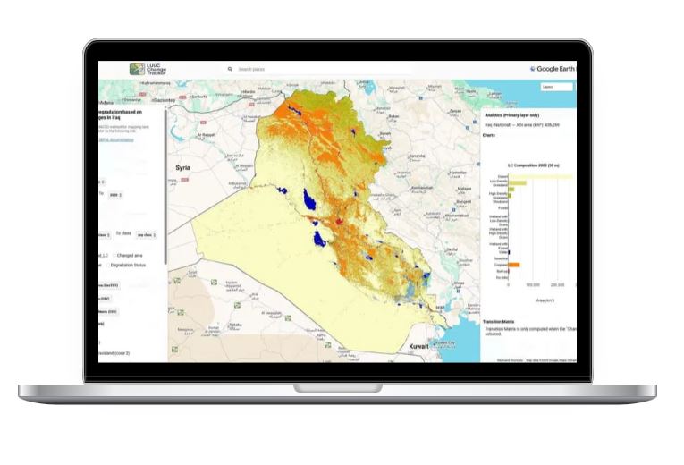
National Land Cover, Change and Degradation Status in Iraq (2000–2020)
Using GLCLU v2 land-cover data and the UNCCD SDG 15.3.1 methodology, this product describes Iraq’s land-cover composition in 2000 and 2020, quantifies transitions between classes, and classifies areas as degraded, improved, or stable. The accompanying maps, charts and statistics offer an authoritative baseline for national reporting and decision-making on land resources.
Learn MoreKnowledge Hub
SLM Best Practices & Guidelines
Events

FAO Iraq, through the GEF-funded project “Sustainable Land Management for Improved Livelihoods in Degraded Areas of Iraq,” is building national capacity to assess and monitor land degradation and support evidence-based SLM decision-making. This training will equip government and local authority staff with practical skills to collect accurate spatial field data and apply advanced remote sensing and GIS tools (e.g., Map Marker, ArcGIS Pro, Google Earth Engine) to feed a digital land degradation monitoring platform. The programme includes two days of field-based training in Basra, six days of technical training in Baghdad, and a two-day platform handover at the Ministry of Environment, delivered by FAO specialist Dr. Mohsen Ramadan.

Southern Iraq faces severe soil salinity that threatens agricultural productivity, crop choices, and farmer livelihoods, driven by poor irrigation practices, intensive cropping, and declining water quality—risks that are worsening under climate change. This follow-up training will equip 27 Ministry of Agriculture extension officers to serve as Farmer Field School (FFS) facilitators on soil salinity management for sustainable agriculture. Trained officers will cascade the knowledge to 2,635 farmers in Thi Qar and Al Muthanna under the FAO–GEF project, promoting practical measures to reclaim and manage salt-affected soils and improve sustainable land and water management.